Ingatestone & Fryerning Neighbourhood Plan Regulation 16
VISION AND OBJECTIVES
The following transport related aims and objectives form part of the vision statement for the IFNP and have been identified to guide the production of the IFNP transport policy:
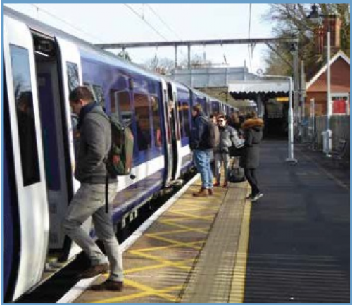
- Giving consideration to effective transport links, the staffed train station (Figure 7), the bus service and access routes for the movement of cyclists and pedestrians.
- To reduce the rate and incidence of congestion.
- To enhance accessibility to key services and facilities within the parish.
- To improve safety on the road network and to enhance and promote a safer travelling environment around the parish.
- To manage the impact of road transport on air pollution.
- To maintain highways and public rights of way to a standard appropriate to their use.
- To support and encourage new technologies such as autonomous vehicles and electric charging points.
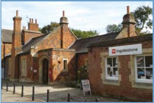
Figure 7: Railway station
CONTEXT
Access by car and parking
The B1002 runs through the centre of Ingatestone, forming the High Street and Roman Road beyond. Ingatestone is a linear village sited between the A12 on the north western edge of the village and the Great Eastern Main Line on the south eastern edge. The A12 provides a bypass for Ingatestone for vehicles travelling between Brentwood, Chelmsford and beyond.
There are around 3,000 cars available to households in the Parish, which equates to around 1.44 cars per household[22]. This is higher than the Essex and national averages for car ownership, which reflects the rural nature of many areas of the parish[23].
There are a total of 398 car parking spaces in Ingatestone, including parking areas in Market Place, the Community Centre, the High Street and Bell Mead. The train station provides 251 car parking spaces, managed by NCP. Parking at the station currently costs £6.80 per day, £27 for a weekly pass and is open 24 hours a day. There are also 48 bicycle parking spaces.
There are few designated street parking spaces in Fryerning, with the exception of two-three spaces outside the Parish Rooms and the church of Saint Mary the Virgin.
In 2016, BBC published the Brentwood Parking Strategy, Strategy Options Development Report[24], which reviewed all BBC owned and operated off-street parking facilities across the borough. The report acknowledged that Ingatestone has parking demand and supply problems, but notes: "that there are limited opportunities to improve the situation due to the size of the town and its geographic location between the railway line (to the south) and A12 (to the north)".
In relation to Ingatestone, the strategy concluded that:
- The provision of additional short-term parking in Ingatestone would be beneficial for accessing the available retail offer, however geographical constraints impede the ability to expand current parking provisions in the area.
- Given the key role of Ingatestone as a commuter location, an appropriate balance between short-stay and commuter parking is required.
- Improved wayfinding and signage infrastructure can help to improve navigation for visitors and help to identify the location of all car parks.
- Effective enforcement can help to improve the efficiency and management of parking and minimise incidences of inappropriate parking and speeding.
The parish council recognises the need for additional car parking provision within Ingatestone and will therefore be supportive of development proposals which provides or contributes towards improved additional parking. ECC are currently undertaking a parking safety survey of Ingatestone.
This survey is expected to identify areas of the village where parking arrangements may need to be amended to ensure the safety of all users. Through the progression of this work, the parish council will seek to work with ECC to consider how parking within the village, particularly around the High Street, could be improved and expanded to meet existing and future parking requirements.
In addition, the parish council will also liaise with Abellio Greater Anglia and Network Rail to consider the possibility of increasing car parking facilities at Ingatestone train station. If parking provision at the station cannot be increased sufficiently, consideration could be given to the development of paid parking elsewhere in the village.
IFNP Transport Policy 5 seeks to improve and where possible increase parking provision for local businesses, customers and commuters within the parish. The parish council will therefore not be supportive of proposals which may reduce the provision of parking within Ingatestone.
With the exception of the NCP train station car park, the majority of parking within Ingatestone is free and feedback from the summer 2018 IFNP questionnaires identified that local people consider existing parking provision in the parish to be vital in supporting Ingatestone's shops and businesses. The questionnaires identified parking as one of the top three items of concern for respondents.
Questionnaire responses identified the following parking related issues in the parish:
- The lack of all-day parking around New Road and the High Street.
- The cost and availability of parking for employees without their own spaces.
- Dangerous parking in the High Street and its junctions. Parking around the schools at drop-off and pick up times.
- The provision of sufficient parking within new housing developments.
BBC adopted the Essex Parking Standards[25] as a Supplementary Planning Document (SPD) in 2011 and continues to expect new development to comply with these design and provision standards. The IFNP supports this approach and will therefore expect all new development proposals in the parish to accord with the Essex Parking Standards. The provision of car parking in new developments needs to be carefully designed and positioned to create a distinctive sense of place and ensure that the parking area does not dominate the public realm.
Sustainable transport
The Climate Change Act commits the UK to reducing CO2 emissions and at international level the Paris Agreement commits the UK to taking action on climate change to reduce global average temperatures. The approach to transport planning within IFNP Transport Policy 5 should reflect the need to reduce CO2 emissions in the parish to support climate change mitigation.
Sustainable modes of transport are transport modes which do not rely on the car, such as walking and cycling and public transport such as buses and trains. Encouraging the use of sustainable modes of transport will support a reduction in carbon emissions within the parish. This approach is therefore connected to the aims and objectives of the IFNP Chapter on Environment, Environment Policy 6.
As outlined in chapter five, in addition to encouraging sustainable modes of transport, electric vehicles will also provide an opportunity to reduce carbon emissions and air pollution.
The inclusion of electric vehicle charging points within new development will therefore be supported and encouraged, or as a minimum infrastructure to support the provision of charging points in the future should be provided.
Public transport services in the parish are only available within Ingatestone. The Great Eastern Main Line runs between London Liverpool Street and Norwich, with access to the Braintree spur line and services to Clacton on Sea and Ipswich. The 23 mile journey to London Liverpool Street from Ingatestone takes around 32 minutes, with regular services at peak times, reduced half hourly off peak services on weekdays and Saturdays and hourly services on Sunday. Ingatestone Station and all trains serving it are currently operated by Abellio Greater Anglia.
Ingatestone Station opened in 1844 and the station is a Grade II listed building. Facilities at the station include a waiting room, part-time café, toilets, a quick fare ticket machine and a staffed ticket sales office.
Feedback within the IFNP questionnaires highlighted the importance of maintaining staff at the station, which is considered important for the safety of passengers, particularly in relation to the safety of a large number of school children that commute into the village daily to attend the Anglo European School.
In recent years passenger numbers at Ingatestone Station have significantly increased. This is due to the accessibility of the station from surrounding areas and the availability of parking facilities near the station. As outlined above, the increased use of the station has detrimentally affected the availability of parking in the village during weekdays, as many commuters will park cars for the day within the village.
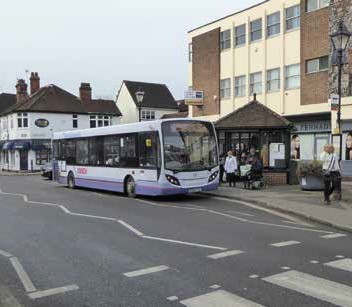
The only bus service operating in the parish is the 351 bus route which runs along Ingatestone High Street, providing services between Brentwood and Chelmsford, half hourly from 6am until 6pm on weekdays, hourly services to 8pm on Saturdays and limited services on Sundays.
In relation to facilities for pedestrians and cyclists, there are no dedicated cycle routes within the parish, pavements in some areas of Ingatestone are narrow and difficult to use for people with prams or using wheelchairs and mobility scooters and there are no pavements on some roads leading out of Ingatestone, throughout Fryerning and on the majority of rural roads in the parish (Figure 12). Policies within the Local Development Plan (LDP) seek to provide new cycle lanes as part of new developments to increase opportunities for cycling safely.
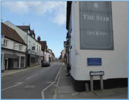
Figure 12: Narrow pavement
IFNP chapter six refers to the importance of accessibility and opportunities to exercise through walking and cycling, for people's wellbeing and quality of life. Policy 5 seeks to enhance and improve pedestrian and cycle routes and accessibility to services and facilities, throughout the parish. Improving the safety and quality of pedestrian and cycle routes within the parish is key to encouraging people to consider walking and cycling as viable alternatives to the car.
The parish council will support development proposals which positively address the needs of pedestrians, cyclists and horse riders. Careful consideration should be given to creating convenient and safe links to surrounding areas. The parish council is also keen to encourage children to develop travel habits relating to walking and cycling which they will continue throughout their lives. Proposals which improve walking and cycling access to schools within the parish will therefore be supported.
A path on Fryerning Lane connects Ingatestone and Fryerning, however the path does not have lighting along the length of the route and is inconsistent in relation to size and quality. An improved path, sufficient to accommodate both pedestrians and cyclists, would encourage the use of this route by pedestrians and cyclists. Within Fryerning there are no pavements, cycle lanes and limited bridleway routes and within Ingatestone there are a number of roads (see Table 1) with poor quality or no pavements. The parish council would therefore be supportive of proposals which improve and increase the provision of bridleways, pedestrian and cycle links within the area. The parish council will also seek to ensure that any new proposals for bridleways, pedestrian and cycle links take into account the needs of all users, particularly people that rely on wheelchairs and mobility scooters.
Table 1: Areas of concern for the safety of pedestrians in the parish
LOCATION
High Street, adjacent to the steps entrance to the Star Inn Public House, Ingatestone village
High Street, on the corner of the Bella Blake shop, Ingatestone village.
ISSUE
The pavement is narrow, only 78cm wide.
LOCATION
High Street, near Budgens, Ingatestone village.
ISSUE
The pavement is narrow, only 91cm wide.
LOCATION
Stock Lane, Ingatestone village.
ISSUE
No pavement in an area which is likely to have a demand for pedestrian access as a result of surrounding existing buildings and the location of the allotments.
LOCATION
Sections of Bakers Lane, Ingatestone village.
The junction of Fryerning Lane and the High Street, Ingatestone village.
ISSUE
No pavement in an areas which are likely to have a demand for pedestrian access as a result of surrounding existing buildings. These roads are also used by pupils of the Anglo European School coming to and from Ingatestone Station and bus service on the High Street.
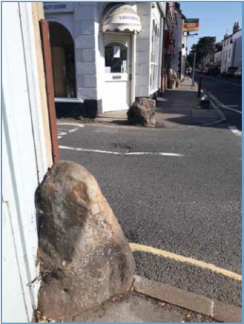
Figure 13: Fryerning Lane and High Street-stones
Safety
The lack of separated cycle routes and good quality pavements in some areas of the parish was identified as a safety concern within the results of the IFNP questionnaire.
Table 1 lists areas of the parish where there are safety concerns for pedestrians relating to the provision and quality of pavements. The identified sections of pavement on the High Street are in areas which have high numbers of pedestrians through people accessing shops, pubs, restaurants and St. Edmund and St. Mary's Church.
Sections of Fryerning Lane (Figure 13) and Bakers Lane (Figure 14) without pavements are of particular concern in relation to pedestrian access for pupils of the Anglo European School coming from the train station. On weekdays, hundreds of children walk from the station and from bus services on the High Street to the school at least twice a day and there are safety concerns on sections of the route without pavements. The safety of these children in walking through the village from passing traffic is a significant concern for the parish council.
Through the IFNP questionnaire local residents have raised their concerns regarding the safety of pedestrians and cyclists in the parish where there are no dedicated cycle lanes and poor- quality paths. Unless improvements to the safety of pedestrians and cyclists can be implemented, it is unlikely that the level of cycling and walking will increase within the parish.
The speed limit on roads within the village, including those where there are safety concerns for pedestrians, is 30 mph. To increase the safety of the village in areas where pedestrian footfall is highest, the parish council will seek to engage with ECC to consider reducing speed limits to 20 mph. These areas include the walking route for pupils of the Anglo European School to go to and from Ingatestone station.
To increase the safety of pedestrians around schools, the parish council is also considering the creation of 'School Clear Zones' within Ingatestone, which are areas around schools where the parking or stopping of cars is restricted at specific times of the day associated with school opening and closing times. The purpose of the zone is to significantly reduce traffic from around the immediate vicinity of the school, improving safety for pedestrians and cyclists and also improving air quality around the school. The pupils will be encouraged to walk or cycle from home or drop off zones, encouraging additional physical activity. The proposed location of the School Clear Zone in Fryerning Lane is currently being investigated by the parish council.
The area of Ingatestone village associated with concerns for the safety of pedestrians, proposed speed reductions and proposed School Clear Zones is identified within Policy 5 as a 'Safe Route'. Within the allocated Safe Route, the parish council will seek opportunities to improve safety for pedestrians and cyclists, where possible, including the provision of:
- New pavements or designated areas of the road for pedestrians.
- Improved road markings. A school clear zone.
- Speed reductions.
- Features which reduce the speed of vehicles, such as speed humps, reduced road widths, speed cameras and additional signage requesting vehicles to reduce speed.
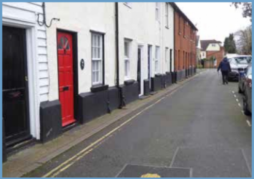
Figure 14: Bakers Lane
Air Quality
IFNP Policy 5 seeks to ensure that new development does not result in an increase in traffic and congestion which could have a detrimental impact on air quality in the parish.
This requirement is connected to the aims and objectives of the IFNP Chapter on Environment, IFNP Policy 6.
As outlined in chapter five, the parish council will consult with BBC to consider options for air quality monitoring within the parish on Ingatestone High Street and close to Ingatestone Infant School on Fryerning Lane. In the absence of any regular monitoring, all new major developments (10 dwellings or more[26]) in the parish will be required to demonstrate an understanding of the current air quality surrounding the development site and outline the potential wider air quality implications of the proposed development on the parish.
Proposed transport improvements for the parish
Through the IFNP summer 2018 questionnaires and additional research to inform the production of this plan, the key transport related projects listed within Table 2 have been identified to maintain and improve accessibility and transport links within the parish.
Table 2: Key transport related projects for the parish
|
PROJECT |
ACTIONS REQUIRED |
|
Improve and increase car parking for commuters using Ingatestone Station. |
Engage with Abellio Greater Anglia and BBC to consider options for the future. |
|
Improve and increase car parking within Ingatestone village. |
|
|
Improve bridleways, pedestrian and cycle routes throughout the parish. Key locations include:
|
|
|
Ingatestone Safe Route, including:
|
|
Proposals that provide or contribute towards new or improved car parking provision within Ingatestone will be supported.
Proposals for new or improved bridleways, pedestrian and cycle routes connecting Ingatestone and Fryerning and within Ingatestone, Fryerning and Mill Green, will be supported.
Proposals for new development should:
- Provide car and cycle parking in accordance with the Essex County Council Parking Standards [16].
- Not result in a reduction in car parking spaces within Ingatestone.
- Where possible and appropriate, contribute towards improved or additional car parking facilities within Ingatestone.
- Not result in any detrimental impact on local highway safety and where possible improve highway safety, within the parish.
- Where possible, protect and enhance public rights of way, pedestrian and cycle routes and bridleways throughout the parish.
- Not significantly increase levels of congestion within the parish.
- Where appropriate, improve accessibility and increase the use of sustainable modes of transport within the parish by providing or contributing towards public transport improvements and providing safe pedestrian and cycle routes to surrounding areas, public transport and local services and facilities.
- Provide effective enforcement to signed speed restrictions.
- Not detrimentally impact air quality and public health within the parish as a result of increased traffic flows and congestion.
- Create safe and accessible environments, particularly for those with limited mobility.
- Incorporate appropriate and sympathetic lighting to public areas which will enhance accessibility and safety.
- Provide infrastructure to support electric and low emission vehicles.
Major development (10 dwellings or more[27]) proposals in the parish should assess and clearly demonstrate the impact of the scheme on the local highway capacity and public transport services.
Proposals which improve the safety of pedestrians and cyclists will be encouraged and supported.
Relevant evidence base documents:
- Brentwood Parking Strategy, Strategic Options Development Report, JMP Consultants Ltd, 2016.
- Parking Standards, Design and Good Practice, ECC, 2009.
- Rural Community Profile for Ingatestone and Fryerning, Rural Community Council for Essex (RCCE), 2013.
- Town and Country Planning (Development Management Procedure) (England) Order 2015.
[22] Based on 2011 Census data.
[23] Rural Community Profile for Ingatestone and Fryerning, Rural Community Council for Essex (RCCE), 2013.
[24] Brentwood Parking Strategy, Strategic Options Development Report, JMP Consultants Ltd, 2016.
[25] Parking Standards, Design and Good Practice, ECC, 2009.
[26] Major developments as defined within the Town and Country Planning (Development Management Procedure) (England) Order 2015
[27] Major developments as defined within the Town and Country Planning (Development Management Procedure) (England) Order 2015.