Ingatestone & Fryerning Neighbourhood Plan Regulation 16
HERITAGE
VISION AND OBJECTIVES
To conserve and enhance the historic environment within the parish.
CONTEXT
For the purposes of this policy, heritage assets are buildings, monuments, sites, places, areas or landscapes which are identified as having a degree of significance meriting consideration in planning decisions because of their heritage interest. This includes designated heritage assets and non- designated heritage assets which are included within the BBC local list of non-designated heritage assets.
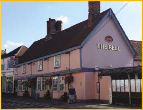
Figure 5: The Bell
The parish contains a large amount of heritage assets, including three conservation areas identified within the assets maps (Maps 3, 4 and 5). Two conservation areas are located within Ingatestone, which was a major and prosperous coaching village from the end of the 18th century and early 19th century, mainly due to its location on the old Roman Road between London and Colchester. The village still contain some historic coaching inns (Figure 5) where the predominant architectural style is Georgian. The village also still retains the original medieval street plan with many property boundaries dating from that period.

Figure 6: Almshouses
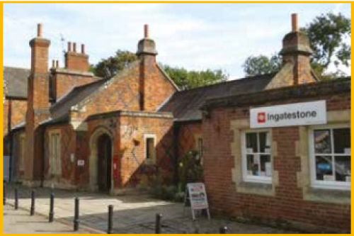
Figure 7: Ingatestone Station
The High Street Conservation Area contains 35 designated heritage assets and a number of protected trees within the historic core of the village. Traditional shop fronts are an important character feature of the High Street and there are a large number of undeveloped rear yards accessed through carriage arches and narrow openings in the building line. The brick tower of the church of St. Edmund and St. Mary provides a landmark feature which contributes to attractive views throughout the village. The High Street is densely built up with buildings predominantly abutting the pavement edge.
The Station Lane Conservation Area contains five designated heritage assets and is predominantly residential containing substantial detached houses in large garden plots set back from the road edge. The character is derived largely from houses built in the late 19th and 20th centuries, including Victorian buildings which provide strong architectural character to the area.
The Ginge Petre Almshouses (Figure 6) and the railway station (Figure 7) are important Grade II listed buildings within the conservation area, built in the 1840's in a picturesque red brick
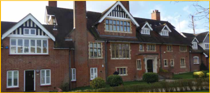
Figure 8: House designed by George Sherrin
Tudor revival style. The conservation area contains buildings by Victorian architect George Sherrin (Figure 8). These buildings have shaped the character and appearance of the conservation area, often featuring red brickwork, clay tiles and false half- timbered gables. The Red House Lake was associated with Sherrin's own home, the Gate House and therefore forms an important historic landscape feature within the conservation area.
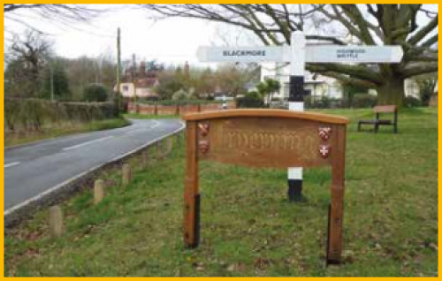
The third conservation area in the parish is located in Fryerning (Figure 9). The village is located on a gently hilly landscape which would have been attractive to early settlement and St Mary's church is located on a prominent hill at the southern end of the conservation area and village. The Fryerning Conservation Area consists of detached houses set on spacious plots. Large oak trees make a significant contribution to the character of the conservation area, enhancing the seclusion of the individual houses and shading the lanes. Apart from one or two late medieval and Georgian buildings, most of the houses are 20th century in the Arts and Crafts style. The houses around Mill Green Road form a notable group of buildings in this style.
The parish has a historic character and appearance which should be preserved and where appropriate enhanced, for the enjoyment of current and future generations.
Figure 9: Fryerning Sign
POLICY 3: HERITAGE
- Development within conservation areas which are identified on the Parish Map and should demonstrate how the proposals will protect and where possible enhance, the character, appearance, setting and historical interest of the conservation area.
- Development proposals should seek to protect and where appropriate enhance, heritage assets within the parish. Development proposals which affect a designated or non-designated heritage asset should outline the historical significance of the asset and the local importance of the asset to the character and appearance of Ingatestone and Fryerning and should clearly outline the impacts of the proposed development on the historical significance and local importance of the asset.
Relevant evidence base documents:
- Ingatestone High Street Conservation Area Appraisal and Management Plan, ECC, 2008.
- Fryerning Conservation Area Appraisal and Management Plan, ECC, 2011.
- Station Lane, Ingatestone, Conservation Area Appraisal and Management Plan, ECC, 2008.