Ingatestone & Fryerning Neighbourhood Plan Regulation 16
VISION AND OBJECTIVES
The following housing related objectives form part of the vision statement for the Ingatestone and Fryerning Neighbourhood Plan (IFNP):
- Supporting measured, proportionate, timely and sustainable development to meet local requirements, particularly those of our young people and older residents.
- Influence key 'age friendly' issues, including housing.
The following housing related objectives have been identified by the Neighbourhood Plan Advisory Committee (NPAC) to guide the production of the IFNP housing policies.
- To promote an integrated approach to achieving sustainable and quality residential environments.
- To promote the comprehensive planning and development of residential areas and ensure that adequate information accompanies planning applications which will enable the delivery of an improved design quality.
- To ensure that adequate provision is made for infrastructure and appropriate local neighbourhood facilities as an integral part of residential development.
- To promote quality residential development that:
- Creates places for people which are attractive, locally distinctive and appropriate to their surroundings, safe, convenient, adaptable and easy to maintain.
- Respects and enhances features of value and local character and promotes biodiversity.
- Reduces reliance on the private car, supports movement by pedestrians and cyclists, provides adequate and convenient access to public transport and connects well with the wider locality.
CONTEXT
Housing statistics
The Rural Community Profile for Ingatestone and Fryerning (RCCE, 2013) highlighted the following key statistics[5] associated with housing in the parish:
- The parish has a population of 4,785 and 2,095 households.
- The majority of households in the parish consist of married couples.
- The parish has a lower than national average proportion of one person households.
- The parish has a higher proportion of pensioner households than the national average.
- The majority of dwellings in the parish are detached owner- occupied houses.
- There is a lower proportion of terraced houses and flats in the parish than the national average.
- There is a lower proportion of social and private rented properties in the parish than the national average.
- Median house prices in the parish are higher than national averages for all types of dwellings. Housing in Ingatestone and Fryerning is therefore less affordable than in other areas of the country.
Questionnaire results on housing
Comments raised by local people during Neighbourhood Plan consultation events and through the IFNP Residents' Questionnaire[6], together with consultations organised by Brentwood Borough Council (BBC) for the production of the Brentwood Local Development Plan (LDP) include:
- Acceptance of the need to accommodate sustainable housing development in accordance with the LDP and ensure that the development of sites is appropriate for the village.
- Ensure that the design, style and density of new housing are in keeping with the character of the parish and the rural environment and that it is sustainable, free from flood risk and includes adequate parking provision and appropriate landscaping.
- Ensure that the mix of housing types and supply of social and affordable housing meets the needs of the parish.
- Increase the provision of bungalows and smaller homes for elderly people in particular.
In relation to the future housing requirements of the area, the IFNP Residents' Questionnaire identified that the greatest needs in the area are for three or four bedroom market housing and bungalows. Housing needs identified in the parish through the questionnaire were consistent with the types of houses existing residents would like to see built in the area, where the preference was for two to four bedroom properties. The questionnaire also identified support for more affordable homes, starter homes and housing for older people within the parish.
In relation to housing design within new development, questionnaire responses identified a preference towards designs which respect the scale and style of existing buildings and the use of traditional local building materials.
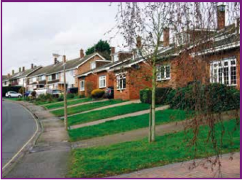
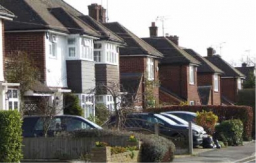
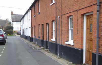
Figure 2: The Furlongs
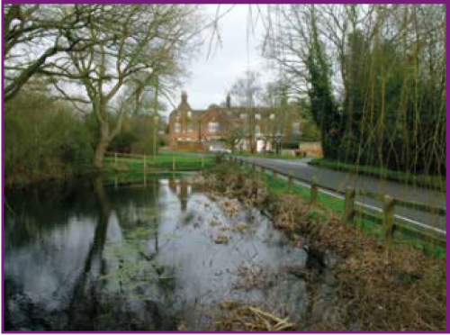
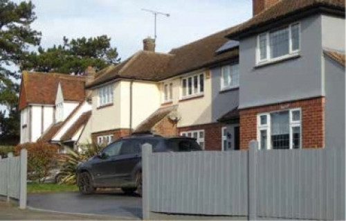
Figure 3: Huskards, Fryerning
In relation to location of new housing in the parish, the questionnaire responses identified a preference towards using brownfield land and seeking to protect greenfield land.
Existing housing in the area
Existing housing in Ingatestone consists of a wide range of styles and designs, often in small estates from various time periods which relate to past expansions of the village. The majority of housing within the village is low density, detached and semi-detached two storey housing, predominantly with front gardens and off-street parking (Figure 2). Older Victorian style properties in the central areas of the village are larger in scale and are located on significantly larger plots with extensive gardens. In the south of the village adjacent to the parish boundary are a higher proportion of smaller bungalows, however along Roman Road leading out of the parish towards Mountnessing housing remains characterised by low density, detached and semi-detached two storey housing with front gardens and off-street parking.
In comparison to Ingatestone, housing areas in Fryerning (Figure 3) are more rural in character and at significantly lower densities. Dwellings are predominantly much larger in scale and located on plots which predominantly include a gated driveway, separate garage and densely vegetated boundaries with extensive gardens. Other rural areas of the parish are characterised by hamlets and dispersed predominantly two storey dwellings on large plots.
Housing requirements in the area
Local housing needs change on a consistent basis and therefore require regular review in order for the parish council to have a good understanding of current housing needs in the area. The parish council will work with BBC to maintain a local housing need register which can inform the allocation of housing in the area and the type and mix of housing being delivered. The parish council will also work with BBC to consider how affordable housing can be prioritised for people with a local connection to the parish and how affordable housing can be retained in the future for people with a local connection.
Paragraph 65 and 66 of the National Planning Policy Framework (NPPF) state that strategic policy making authorities should set out a housing requirement figure for designated neighbourhood areas and where this is not possible an indicative figure should be provided. In accordance with these requirements, BBC has concluded that the IFNP should seek to allocate a minimum of 57 new homes up to 2033.
Map 2: Site allocation R22, land adjacent to the A12 bypass, Ingatestone. Copyright Brentwood Borough Council.
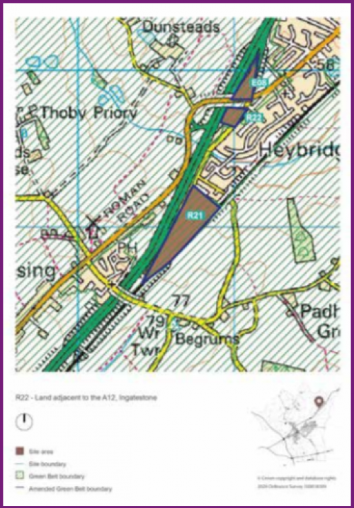
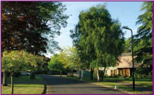
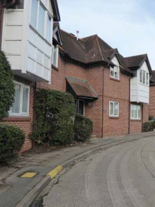
Figure 4: Tor Bryan 1
Housing allocation in the Local Development Plan (LDP)
The Brentwood LDP seeks to deliver an average of 456 new dwellings per annum in the Borough up to 2033. The LDP has allocated 57 dwellings in the parish on site R21 (Map 2), land adjacent to the A12 bypass on the south eastern edge of Ingatestone. The LDP also requires the provision of 35% affordable housing, public open space and a landscape buffer adjacent to the A12. The parish council supports this housing allocation within the LDP and therefore includes this site as an allocation within IFNP Policy 1.
The LDP has also allocated 161 dwellings on land south of Ingatestone, east of the A12, identified as Site R21 in the Local Plan. While this site is located outside of the Neighbourhood Area within Mountnessing, it will still have a significant impact on local infrastructure within the Ingatestone and Fryerning parish. This Neighbourhood Plan will therefore consider and seek to address the impacts arising from the proposed development of Site R21 in Ingatestone and Fryerning parish.
Ingatestone and Fryerning Neighbourhood Plan housing allocation
IFNP Housing Policy 1 allocates Site R22, land off Roman Road, Ingatestone, for the development of 57 dwellings. The site is located at the southern periphery of the village where it effectively forms a gateway site when approached from both Brentwood and Billericay directions.
The site falls within the Mountnessing Critical Drainage Area (CDA). Any development within this area should be directed away from areas of existing flooding and where possible should try to have a positive impact on existing areas of flood risk downstream of the development. Early engagement with the Lead Local Flood Authority (LLFA) and consideration of the most up to date Surface Water Management Plan (SWMP) and associated SWMP Action Plan, is critical to ensure that existing and potential flood risk is properly managed.
Along Roman Road the immediate neighbouring properties to the east date from the 1930's and consist of single two storey detached and semi-detached properties of a low density suburban character. All possess front gardens and have off street parking. South of the site Ingatestone House, a substantial extended Georgian house, exists. Further south are some large detached houses within their own grounds and constructed in the 1970's whereas to the east (opposite) side of Roman Road the Hare Bridge Estate was completed some 13 years ago.
Ingatestone generally contains a mix of all periods, styles and design ranging from Tudor and Georgian to Victorian as well as early and mid 20th century estates and infill sites, including the contemporary private Tor Bryan Estate (Figure 4). This latter is now recognised as being: "a striking and innovative example of a post-war housing development with bold modern architecture, varied detailing and a distinctive palette of materials"[7]. The estate is now included in a conservation area.
Taking into account the site's key location at the entrance to the village, an exceptionally high standard of design is expected, including a scheme that integrates well into its surroundings, creates a positive sense of place and identity and relates well to the existing local area in relation to layout, patterns of form, scale, appearance and materials.
Affordable housing
BBC has proposed an affordable housing requirement of 35% on proposed developments of 11 or more (net) units or sites of 10 or less units which have a combined gross internal floorspace in excess of 1,000 square meters. Site R22 is therefore required to provide 35% affordable housing, which would provide 20 new affordable dwellings within the parish. Ingatestone and Fryerning have high average house prices and there is a shortage of affordable housing in the area. Whilst it is acknowledged that the requirement of 35% affordable housing is based on the viability testing of strategic sites undertaken as part of the production of the LDP to meet local affordable housing needs, the NPAC would support a higher rate of affordable housing where it can be demonstrated that the higher rate would not render the site financially unviable.
New developments within the parish should seek to create inclusive, integrated and well-connected communities. The integration of communities can often be more challenging within new developments where the affordable housing is segregated into one area of the site. The parish council therefore expects affordable housing to be integrated throughout new developments. To ensure a high quality of design throughout the development, the design of affordable units should be indistinguishable from market housing on the site in relation to building design and quality.
BBC manages a sheltered housing scheme within Ingatestone which in total comprises 67 dwellings, including a main building with 10 bedsits and four one bedroom flats, a mixture of bungalows and one bedroom flats on Stock Lane and Wadham Close and Steen Close bungalows off of Fryerning Lane. Ingleton House is part of the sheltered housing scheme located on Stock Lane and has been identified by the NPAC as containing units which are no longer fit for purpose. The existing layout of buildings on the site does not maximise its development potential and it is considered that a reconfiguration of the site could accommodate more housing on the site.
Housing design
The parish council expects new housing development within the parish to be high-quality and affordable, seeking to ensure that everyone has access to a decent home in a human-scale environment that they can afford. The parish council expects new development to enhance local distinctiveness by using architecture styles and design which are characteristic of the parish. Further details are contained in the Housing Design section.
Housing type
The parish has an ageing population, with many residents seeking opportunities to downsize from family sized three or four bedroom properties. The provision of additional older people's housing in the parish would therefore meet this need and would also make available additional family housing to enable younger families to move into or remain in the parish. The Neighbourhood Plan will therefore be supportive of proposals which include housing designed for older people.
- The Plan allocates 57 dwellings on Site R22 (identified in Map 2), land adjacent to the A12, Ingatestone. Development proposals on Site R22 should:
- Respond positively and integrate with existing development surrounding the site, particularly in relation to layout, form, scale, appearance and use of materials.
- Create a strong and positive sense of place and identity.
- Provide planting and landscaping on the western boundary of the site to contribute towards the attenuation of traffic noise from the A12.
- Incorporate noise attenuation measures for dwellings on the west of the site, adjacent to the A12, to meet BS8233:2014 standards[1].
- Provide street tree planting as recommended within the Essex County Council Street Material Guide: Design and Good Practice 2012[1].
- Provide attractive pedestrian and cycle access to Roman Road from all areas of the site.
- Provide appropriate surface water management in accordance with the LLFA's most up to date Sustainable Drainage Systems (SuDS) Design Guide.
- To address the impacts of the development on the surrounding area, Site R22 should provide contributions towards all necessary infrastructure to be secured and delivered, including:
- Education facilities.
- Open space.
- Community facilities.
- Proposals for residential development will be supported where the proposed development:
- Is located within defined development limits.
- Provides as a minimum a rate of affordable housing which is in accordance with the requirements set out in the Brentwood Borough Local Plan. Development proposals which include affordable housing should outline current local social housing
- needs and demonstrate how the proposed housing mix will assist in meeting the identified local needs.
- Locates affordable housing throughout the development, which is designed to be identical in design and quality as market housing within the new development.
- Includes housing types and tenures which meet the current and future housing needs of the parish taking into account the existing housing stock. Development proposals should outline current local housing needs and demonstrate how the proposed housing mix will assist in meeting the identified local needs.
- Is accessible to local services and facilities by good quality walking and cycling routes.
- Provides appropriate surface water management in accordance with the LLFA's most up to date SuDS Design Guide and provides appropriate waste water drainage.
- Contributes positively towards green infrastructure within the parish.
- Would not result in significant harm to heritage assets (both designated and non-designated) in the surrounding area.
- Provides parking in accordance with the adopted Essex County Council Parking Standards.
- Would not result in a detrimental impact on local highway safety and where possible improves highway safety within the parish.
- Protects and enhances important features of the natural environment and biodiversity of the site and its surroundings.
- Provides enhanced connectivity to local services, amenities and public transport.
[5] Unless specified otherwise, all statistics are from 2011 census data.
[6] A summary of the results of the IFNP Residents' Questionnaire is available in the Neighbourhood Plan evidence base on the parish council website www.ingatestone-fryerningpc.gov.uk.
[7] Station Lane Ingatestone Conservation Area Appraisal and Management Plan, ECC, 2008.