Strategic Growth Options
2 Managing Growth
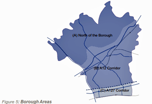
The new Local Plan will need to set out a spatial strategy for where development of all kinds will be located. This needs to be considered in light of evidence, such as transport connections and the capacity of key services. For the purposes of this consultation the Borough has been split into three areas: a) North of the Borough; b) A12 Corridor; and c) A127 Corridor.
Transport Context
2.1 The spatial options within this consultation document need to be considered within the context of wider transport connections. Brentwood Borough is very well connected to London, the South East and the rest of the UK- one of the reasons the Borough is such a desirable place to live work and visit.
2.2 Access to M25 at junctions 28 and 29 providing connections with the rest of the UK. Highways (such as the A12 and A127) connecting the Borough to London, the restof Essex and East Anglia.
2.3 Once Crossrail arrives at Brentwood and Shenfield stations it will provide a more frequent and improved service into London, with links to new stations under Central London, direct links to West London and beyond.
2.4 Access to London Fenchurch Street and London Liverpool Street stations, as well as links to Essex and East Anglia.
2.5 Access via rail and road to London Stansted and London Southend airports, plus direct rail links to London Heathrow Airport once Crossrail is operational.
2.6 Brentwood Borough has a high level of out commuting, with 55% of the workforce travelling to Greater London for work. Commuting flows into Brentwood from neighbouring authorities are also high amongst areas east of the Borough.
Previous Spatial Options and Context
2.7 The Local Plan will need to set out a spatial strategy for where development of all kinds will be located. The vision, strategic objectives and planning policies within the Plan will all be underpinned by the spatial strategy.
2009 Issues & Options Consultation
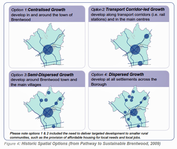
2.8 As part of the Core Strategy Issues and Options consultation (2009) the Council sought public views on four spatial options to guide future development in the Borough at the levels required by the (then) regional plan, the East of England Plan. Options were as shown in Figure 4.
2013 Preferred Spatial Strategy
2.9 The 2013 Preferred Options consultation document proposed a spatial strategy that derived from the options shown in Figure 4. This was to focus growth in Brentwood, Shenfield and West Horndon along with suitable developed sites in the Green Belt and brownfield development in other villages. This was a variation on spatial option 2 above (Transport corridor-led growth) as it proposed proportionately more growth at West Horndon because of the comparative capacity for growth in that location, and less growth in Ingatestone because of capacity and land constraints.
2.10 This proposed spatial strategy was fundamentally based on the lack of capacity in the Brentwood urban area and north of the Borough in terms of infrastructure such as roads (due to congestion), primary schools, GP facilities and a higher landscape value.Whereas the A127 Corridor presents an opportunity to improve the capacity of the above and specifically create a sustainable centre for West Horndon village.
2.11 However, in light of the changes since 2013 (as set out in paragraph 1.10), the level of growth required is now higher, specifically the need to meet full housing need. Therefore, it may not now be the most sustainable option to progress with this strategy. For this reason, this document sets out the growth options available so that consultation can inform the Council’s decision about where the required growth should be proposed.
Growth Options
2.12 As work preparing the Local Plan progresses, the spatial strategy is evolving as informed by national policy requirements, technical evidence and consultation responses. For the purpose of considering approaches to future development the whole Borough can be divided into three broad areas. These have been drawn up to focus on existing transport corridors. Any housing provision over 2,500 homes within Brentwood Borough will need to consider the use of Green Belt. This is the amount that could be sustainably developed on available brownfield land.
2.13 Each of the areas should not be considered in isolation. The following sets out the three areas that have different characters and issues to consider and therefore could accommodate different approaches to development. Figure 5 and Figures 6a, 6b and 6c set out the three areas.
(645)
 Q1: Do you agree with the
three broad areas, for the purpose of considering
approaches to growth?
Q1: Do you agree with the
three broad areas, for the purpose of considering
approaches to growth?
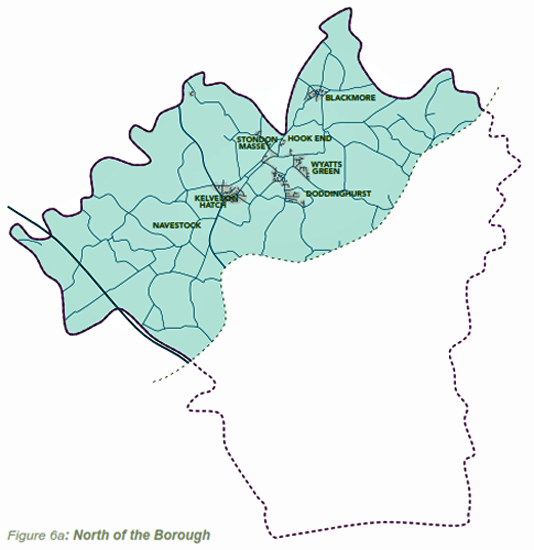
2.14 This area is made up of a collection of villages set amidst attractive natural landscape.
2.15 It is important to consider allowing villages to grow in order to provide for local need. Brownfield land in Green Belt could be redeveloped on limited sites (where appropriate), and/or sites on the edge of villages could be released. These options will need to be considered in addition to maximising brownfield land within villages, although this type of land is not readily available. Transport connections and local facilities are not as good in this part of the Borough and so it would not be sustainable to locate significant growth in the area. Local roads provide access to connecting A-roads such as the A414, which provides access to the M11 and Chelmsford without driving on the highway network.
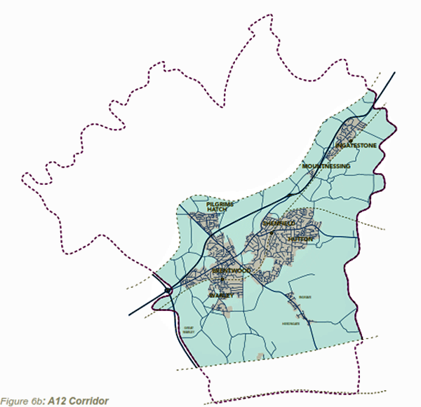
2.16 The A12 Corridor contains a wide range of land uses. It contains the Brentwood urban area, made up of Brentwood and Shenfield but also including Brook Street, Hutton, Pilgrims Hatch and Warley. The corridor also includes Ingatestone and Mountnessing.
2.17 Brownfield land in existing urban areas would need to be utilised efficiently as part of future growth options. However, in addition there are development opportunities surrounding the urban areas, within the Green Belt. Access to Brentwood from the A12 is only from Brook Street (M25 junction 28) and Mountnessing (A12 junction 12), bypassing the town centre but limiting the outlet of local congestion.
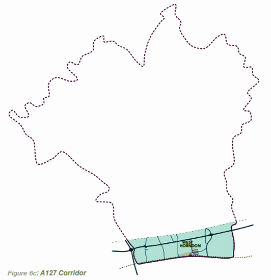
2.18 The A127 Corridor contains the single settlement of West Horndon. This part of the Borough has a different landscape character (fenland landscape, see Figure 16).
2.19 Due to the different character and availability of suitable land the capacity for growth is potentially greater than elsewhere in the Borough. Although the A127 suffers from congestion problems it has more scope for improvements than the A12.
(619)
Q2: Do you agree with the
issues raised for each of these three areas?